I set myself to a project of exploring some data sets and to quickly make a choropleth that shows that exploration. When I do that I usually use command line tools like ogrinfo. The project goals were to identify areas where I couldn't find a command line tool to use, and make that tool. I am exploring Minnesota Block Group level Census data in combination with location of educational institutions.
First up, queries that I know how to do:
non-spatial summary statistics on a single table
Min, Max, Avg 2016 Population Estimate for each Block Group in Minnesota
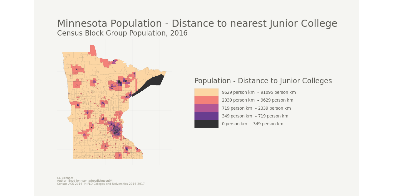
I wondered about population in combination with the distance to the nearest educational institution. I chose Junior Colleges from my data set to be specific. This is where I am missing a tool that I can quickly leverage to make a spatial join, so I worked on building it. Enter ndjson-spatial:
spatial metrics on two tables
Distance to nearest Junior College from centroid of Block Group, Minnesota
Thematic Map showing distance to nearest Junior College multiplied by population estimate